

Geography
“It is not the mountain we conquer but ourselves.”
Sir Edmund Hilary
Geography
Studying Places and the Spatial Relationship between
People and their Environments

Year 4 children learning using atlases and globes
Map work
From the Reception year children start to make pictoral representations of journeys and sequence familiar places gaining an understanding of location and where places are positioned in relation to one another.
Through Key Stage 1, children learn about familiar human and physical geographic features and learn to map these, building an understanding of plan views. Atlases are used to locate and draw Sheffield and other cities onto outline maps of the British Isles. Children also look at larger scale atlases and globes e.g. in connection with our New York, New York topic.
In Key Stage 2, children use atlases regularly, building their knowledge and understanding of place on a range of scales. They use physical, political and thematic maps to help build an understanding of how the physical environment influences human features. For example during the Amazon topic in Year 3 and by studying the growth of Sheffield in Year 4. Children use IT to develop their mapping interpretation skills.
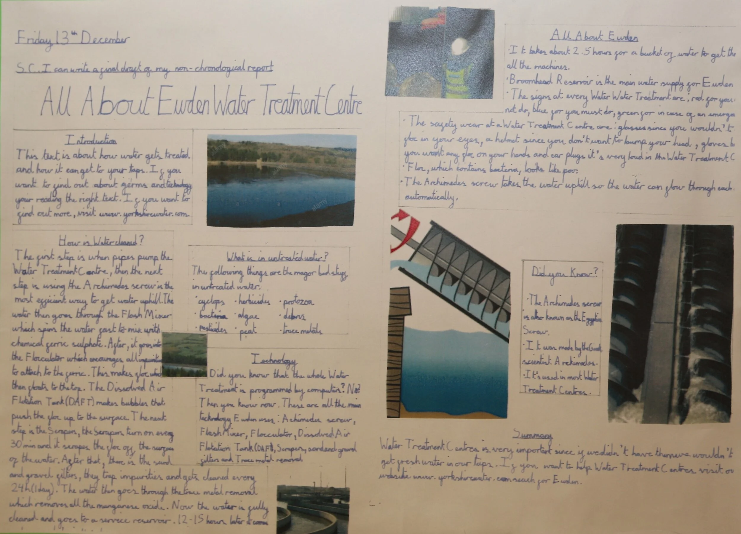
A Year 5 report about their field trip to Ewden Water Treatment Centre
Fieldwork
Without first hand experiences Geography can seem a very abstract concept. Pupils at Loxley develop their understanding of the world through first hand experiences from the Reception year.
In Key Stage 1, children use aerial photographs of the school and explore the school grounds using observational skills. In Year 2, they develop their understanding of key human and physical features from local fieldwork.
In Key Stage 2, various visits including exploration of the River Loxley and it’s impact on industrial development, our visit to a water treatment works connecting with learning about the water cycle and our town study of Scarborough in Year 6 build interest and measuring and recording skills.
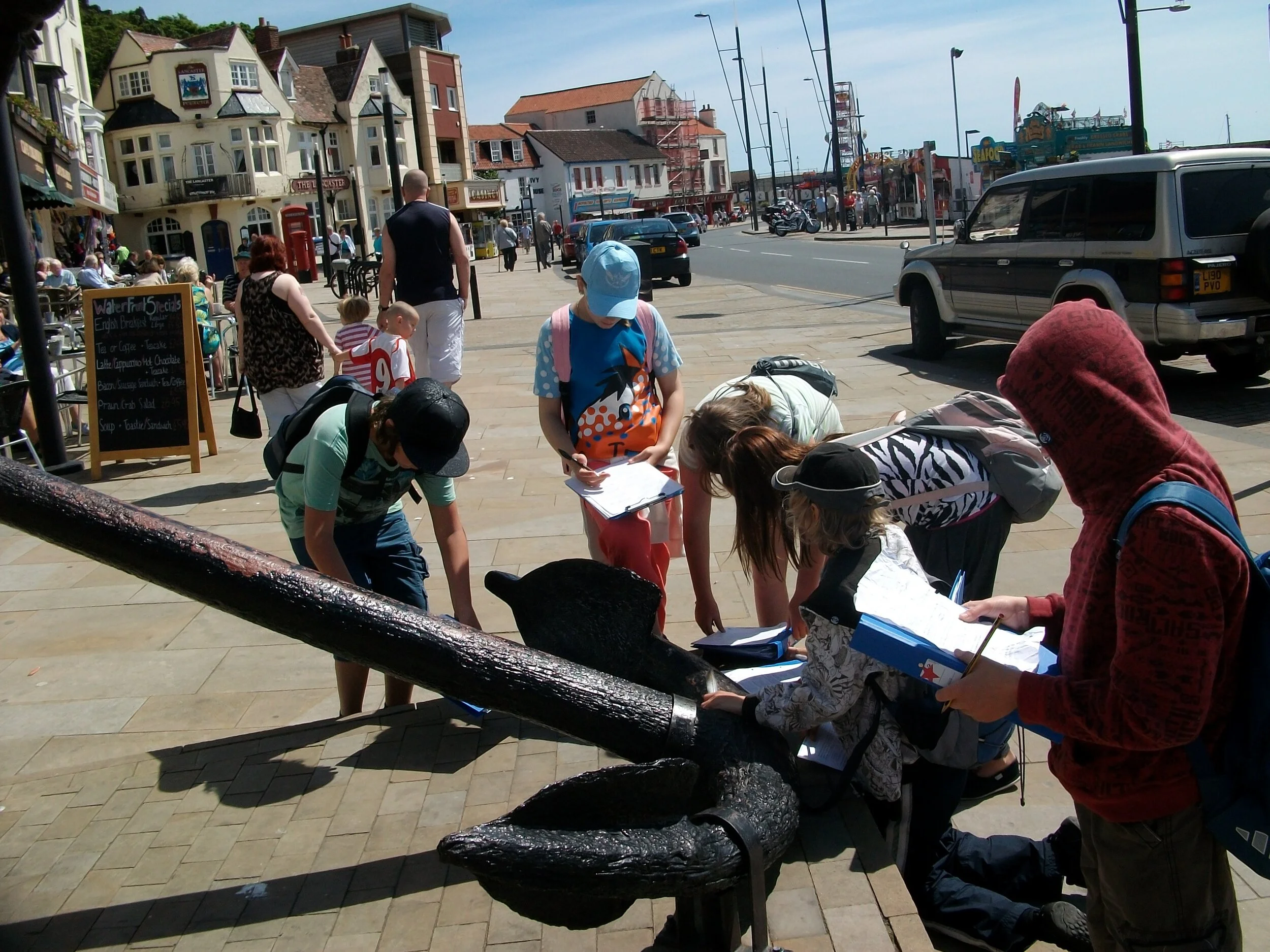
Children using first hand evidence to answer Geographical questions during our Scarborough residential visit.
Being Geographers
We think it’s very important for children to think of themselves as Geographers, exploring the world around them with interest and with enquiring minds.
This is why our approach to Geography is through enquiry questions. Some of these are posed by the teacher e.g. What makes a sustainable city? What is life like in the Amazon Rainforest? Other questions that are posed by children can be investigated during the topics.
Our knowledge explorers give structure and progression in terms of geographical concepts, skills and vocabulary. We enable children to interlink understanding between themes such as settlements and rivers through the age range.